Anthony Hay House (NB) Archaeological Report Vol. II, Block 28 Building 71 Lot 263-264Originally entitled: "The Anthony Hay Site Block 28,
Area D, Colonial Lots 263 and 264. Volume II"
Colonial Williamsburg Foundation Library Research Report Series - 1553
Colonial Williamsburg Foundation Library
Williamsburg, Virginia
1990
THE ANTHONY HAY SITE
Block 28, Area D Colonial Lots 263 and 264REPORT ON ARCHAEOLOGICAL EXCAVATIONS OF 1959-1960
SELECTED ILLUSTRATIONS OF FOUNDATIONS
AND OTHER EXCAVATED FEATURES
Volume II.
TABLE OF FIGURES
| Figure 1 | Cabinet shop excavations, | view from west |
| 2 | southwest corner | |
| 3 | west foundation | |
| 4 | west foundation interior | |
| 5 | east foundations | |
| 6 | northeast foundation | |
| 7 | east foundation and site of chimney | |
| 8 | post holes around chimney foundation | |
| 9 | remains of chimney | |
| 10 | remains of chimney and south balk | |
| 11 | Cabinet shop extension, | southwest pier |
| 12 | northeast pier | |
| 13 | central north pier | |
| 14 | Bridge foundation (?) south of shop extension | |
| 15 | Stream bed flowing between shop extension piers | |
| 16 | Posts in stream silt | |
| 17 | Posts in stream silt | |
| 18 | Wooden platform north of shop extension | |
| 19 | Crest rail of chair in situ | |
| 20 | Pewter plate in silted stream | |
| 21 | East end of test cutting south of shop complex | |
| 22 | Residence, | northeast corner |
| 23 | southeast corner and remains of steps (?) | |
| 24 | remains of south foundation close to southeast corner | |
| 25 | robbed trenches at southwest corner | |
| 26 | Residence, | robbed trench of south foundation |
| 27 | remains of chimney foundation | |
| 28 | paved walk to south | |
| 29 | detail of walk | |
| 30 | Kitchen, | interior of chimney foundation |
| 31 | north foundations | |
| 32 | Remains of paving west of the well | |
| 33 | The Hay well at any early stage of excavation | |
| 34 | brick head from northwest | |
| 35 | brick head from north, partially dismantled | |
| 36 | Test cutting | No. 3 north of shop complex |
| 37 | No. 1 at rear of site | |
| 38 | No. 2 at rear of site | |
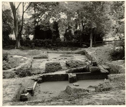 Fig. 1. View across cabinet shop complex with extension piers and west foundation in foreground, and fallen chimney (partially excavated) in the background. Photo from the west. 60-ST-428-1.
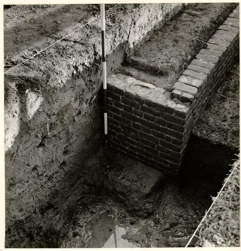 Fig. 2. Southwest corner of cabinet shop with ranging pole standing on the mid-eighteenth century grade. Part of the second stream bed can be seen in foreground. Photo from the southwest. 60-JC-93-6.
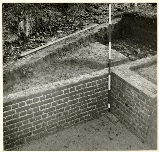 Fig. 3. West foundation wall of Hay shop with southeast pier of the extension abutting against it. The foreground silt has been removed down to the original grade as it existed when the shop was built. Brick rubble inside the shop (background) was deposited when the structure was destroyed. Beyond it can be seen the bed of the modern stream. Photo from the west. 60-JC-93-17.
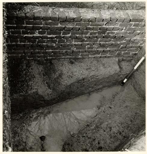 Fig. 4. Section through first stream bed passing beneath west foundation of the cabinet shop. Photo from the east. 60-JC-93-10.
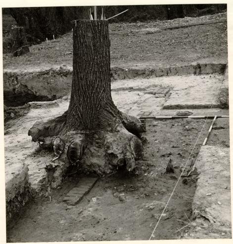 Fig. 5. Pier foundations at east end of shop and position of chimney foundation indicated by ranging poles at an early stage of excavation. Photo from the southeast. 60-ST-140-3.
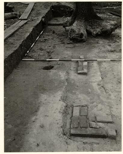 Fig. 6. Northeast corner of the Hay cabinet shop with ranging poles marking outline of chimney foundation. Photo from the north. 60-JC-93-60.
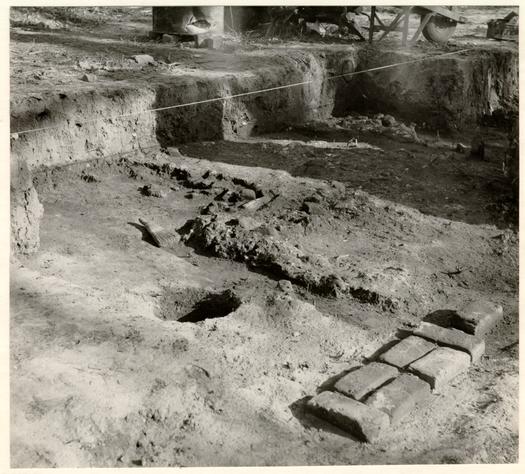 Fig. 7. Pier foundation directly north of cabinet shop chimney and part of the building's east wall. Remains of chimney foundation are seen in the background as well as 19th century post hole. Photo from the northwest. 60-NH-183-9.
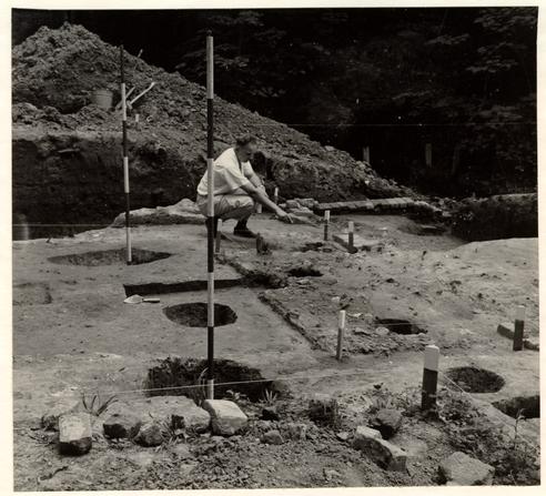 Fig. 8. Site of shop chimney foundation surrounded on three sides by post holes probably for scaffold poles, and pierced by holes (right) for a subsequent fenceline. Photo from the north. 60-ST-428-11.
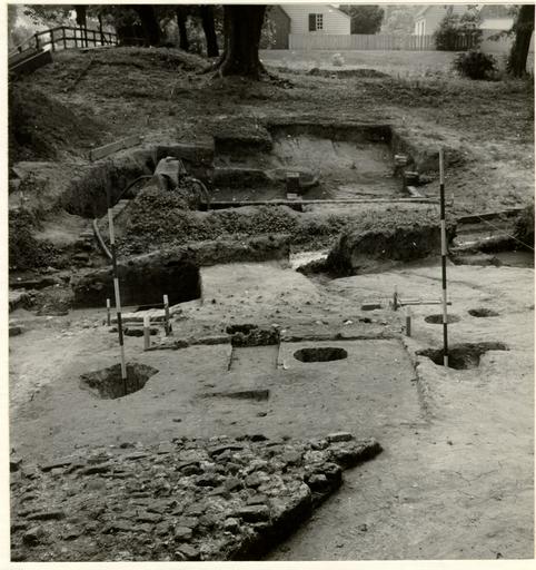 Fig. 9. View across cabinet shop complex with part of fallen chimney in foreground. In the middle distance, marked by stakes, is the site of the chimney foundation, flanked by holes for scaffold poles. Piers of the shop extension are to be seen in the background. Photo from the east. 60-ST-428-10.
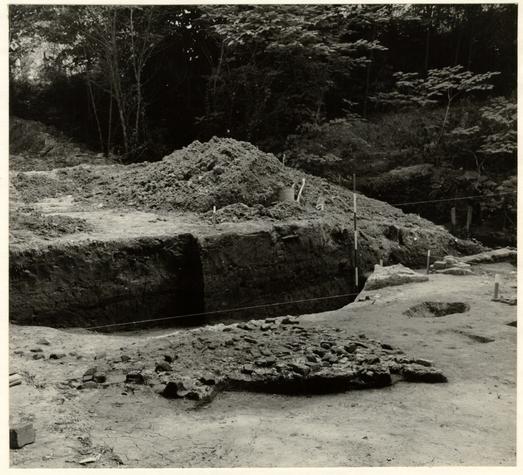 Fig. 10. Part of fallen shop chimney and beyond it a section through stream silt and clay deposited before the shop was constructed. Photo from the north. 60-ST-428-7.
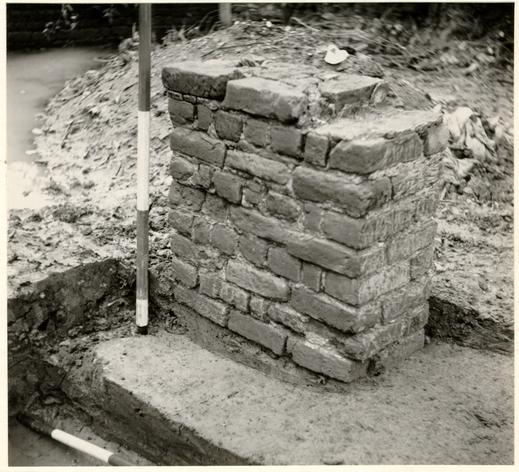 Fig. 11. Southwest surviving pier of shop extension showing its bottom course resting on artifact-bearing silt on the stream's west bank. Photo from the northwest. 60-NH-758-19.
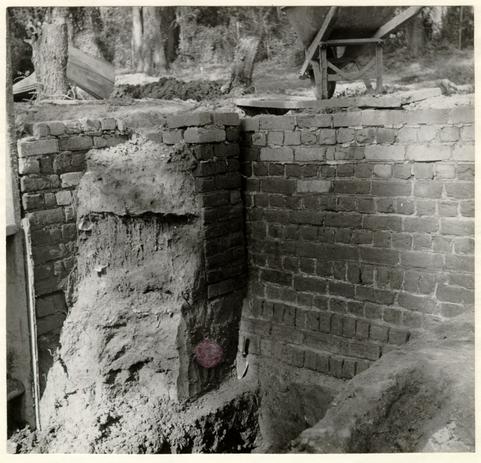 Fig. 12. Northeast pier of extension abutting against west foundation of the cabinet shop. Note base of pier resting on clay fill and change in coursing of shop foundation as it passes over the silt of the first stream. Photo from the southwest. 60-NH-337-9.
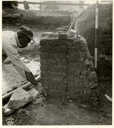 Fig. 13. Middle north pier of cabinet shop extension. Excavator indicates base of pier resting on silt bearing artifacts dating no earlier than circa 1760. Photo from the east. 60-NH-332-3.
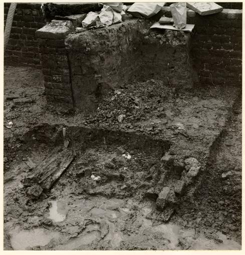 Fig. 14. Part of small timber foundation laid in the second stream silt at a lower level than the base of the southeast extension pier immediately to the left of it. The foundation comprises two parallel series of boards with brick rubble between them and bricks set over the boards, possibly to support a vertical post. Possibly part of the foundation of a bridge. Photo from the southwest. 60-JC-93-37.
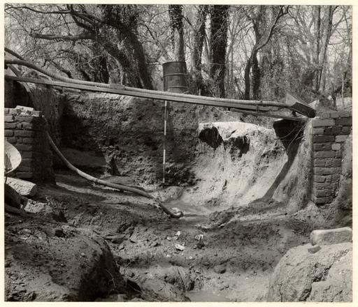 Fig. 15. Stream beds in course of excavation, passing between northern piers of cabinet shop extension. Ranging pole in background stands against thick stratum of silt deposited during the second half of the 18th century. 60-NH-332-6.
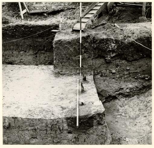 Fig. 16. Posts found in stream silt south of the cabinet shop extension. Slope of natural grade can be seen at right. The dark layer in the background section immediately overlies the top of the 18th century silting. Photo from the north. 60-JC-93-38.
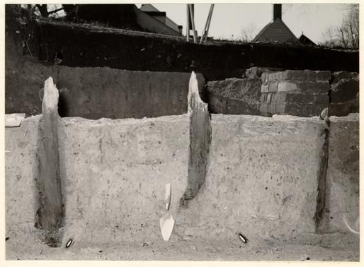 Fig. 17 Posts imbedded in stream silt south of shop extension and probably of late 18th century date. Southwest surviving pier of extension can be seen in right background. Photo from the east. 60-JC-93-34.
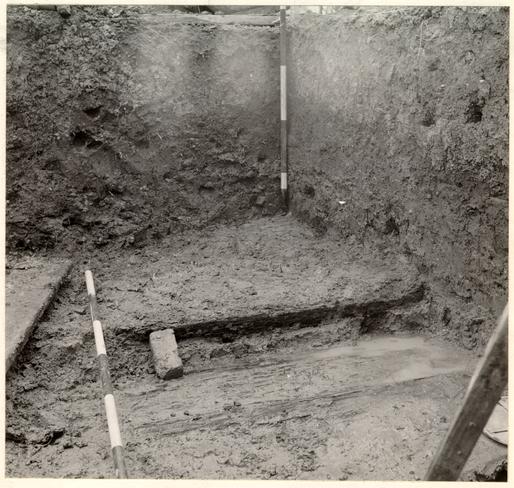 Fig. 18. Remains of timber "platform" north of shop extension and resting on the stream silt. The ranging pole indicates the line of its southern edge, while the brick serves only to support the vertical board that had begun to slip during the course of excavation. Photo from the east. 60-NH-198-7.
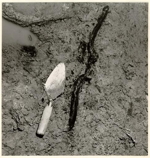 Fig. 19. Crest rail from chair of Chippendale form in situ in stream silt south of the cabinet shop extension. Photo from the west. 60-JC-93-28.
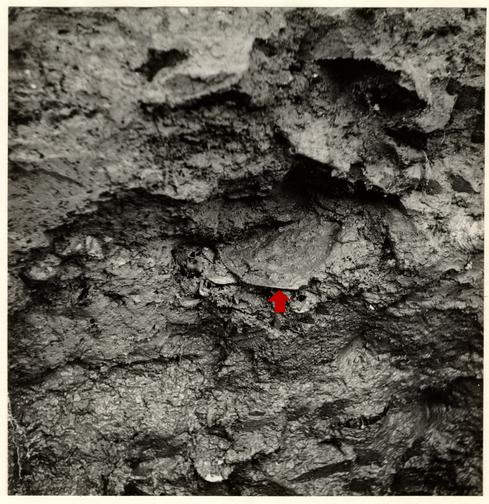 Fig. 20. Remains of pewter plate (arrowed) in silt of second stream north of the cabinet shop. Photo from the south. 60-NH-337-11.
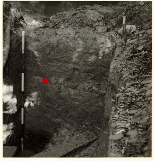 Fig. 21. East end of test cutting through stream silt south of cabinet shop showing layer of laid brickbats (arrowed). See Vol. I, Fig. 9, section 7. Photo from west. 60-841-3.
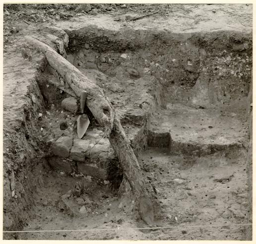 Fig. 22. Northeast corner of Hay residence with 1949 excavation trench shown in section at the rear and supposed corner stob in foreground. Photo from the east. 60-JC-605-4.
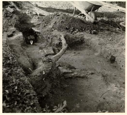 Fig. 23. Probable step foundation with southeast corner of Hay residence indicated by trowel in the background. Photo from the south. 60-NH-337-1.
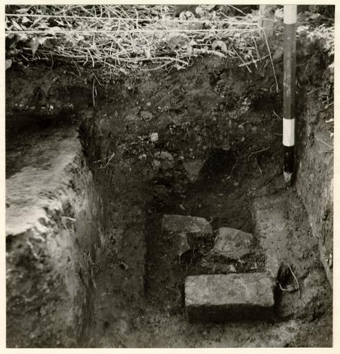 Fig. 24. Traces of Hay residence south wall at south-east corner, the remains comprising brickbats and mortar thrown back into the original wall trench. Photo from the east. 60-NH-347-1.
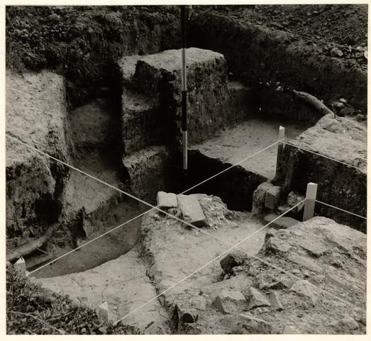 Fig. 25. Robbed trench at southwest corner of Hay residence, corner indicated by ranging pole. Right-angled strings indicate line of west wall and the previously supposed south wall line. Note 1949 stob supported by bricks at right. Photo from the northeast. 60-ST-428-4.
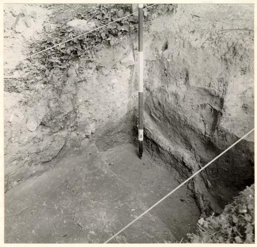 Fig. 26. Robbed trench for south wall of Hay residence abutting against clay bank. Note tree root following line of the wall and back-filled section through 1949 archaeological trench (arrowed). Photo from the northwest. 60-JC-605-3.
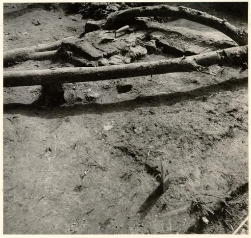 Fig. 27. Remains of internal chimney close to north wall of Hay residence, west and south foundation fragments only surviving. Post "A" in foreground indicates northeast. corner of 3'0" square burnt area. Photo from the northeast. 60-NH-617-7.
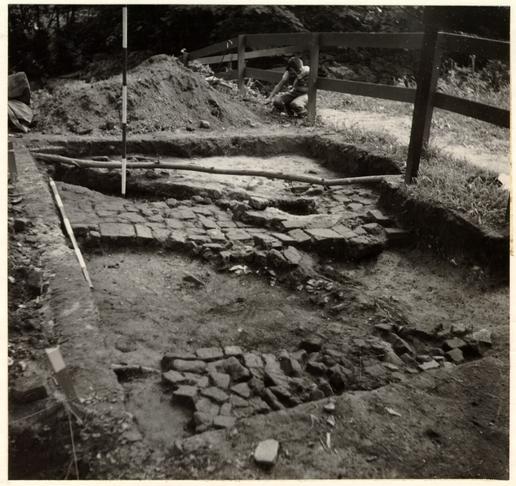 Fig. 28. Paved walk south of Hay residence using bricks and square tiles. Photo from the northwest. 60-NH-643-3.
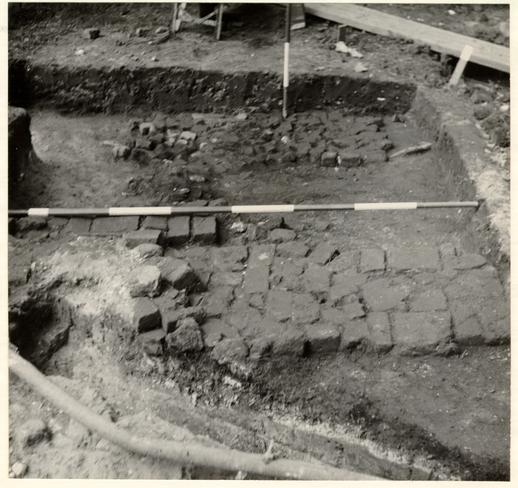 Fig. 29. Paved walk south of Hay residence with reexcavated trench in foreground showing mortar and ash layer in section passing beneath the paving. Photo from the east. 60-NH-643-12.
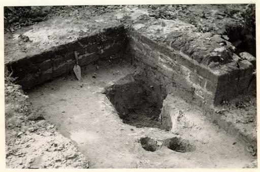 Fig. 30. Kitchen chimney foundation resting on dirty clay fill; in foreground earlier post hole. Photo from the southeast. 60-841-1.
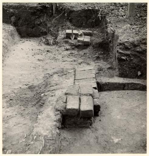 Fig. 31. North foundation remains of kitchen building with northwest corner in background. Photo from the east. 60-NH-643-8.
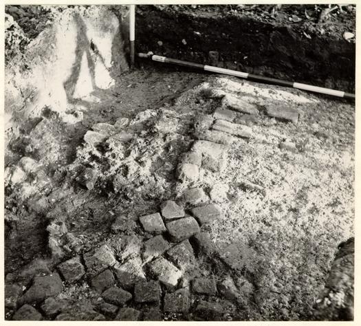 Fig. 32. Rough briokhat paving west of the Hay well and east of the kitchen. Photo from the northwest. 60-NH-758-8.
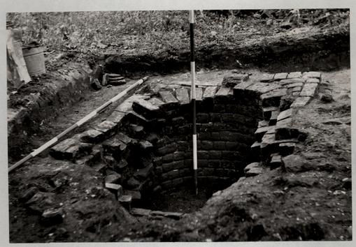 Fig. 33. Remains of the well as first uncovered. Photo from the north. 60-NH-758-6.
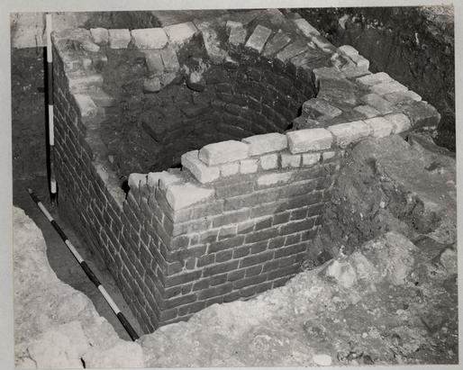 Fig. 34. The well head in course of excavation. Note that the far left (N.E.) corner is resting on silt that slopes down in an easterly direction towards the stream. The late 18th century grade is shown abutting against the well at the right. Photo from the northwest. 60-ST-773-5.
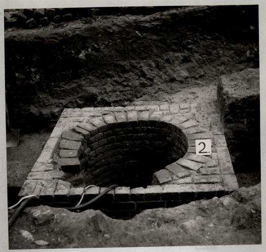 Fig. 35. The well head after the removal of eight damaged courses. Photo from the north. 60-NH-798-6.
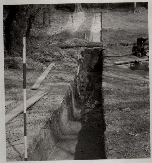 Fig. 36. Test cutting across valley north of the cabinet shop complex showing the second stream bed (second ranging pole) and beyond it the line of the present stream. See Vol. I, Fig. 6, section 3. Photo from the west. 60-NH-198-10.
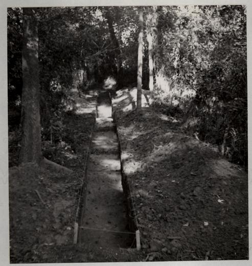 Fig. 37. Test cutting through heavy underbrush to rear of site east of stream. See Vol. I, Fig. 8, section 1. Photo from the west. 60-841-4.
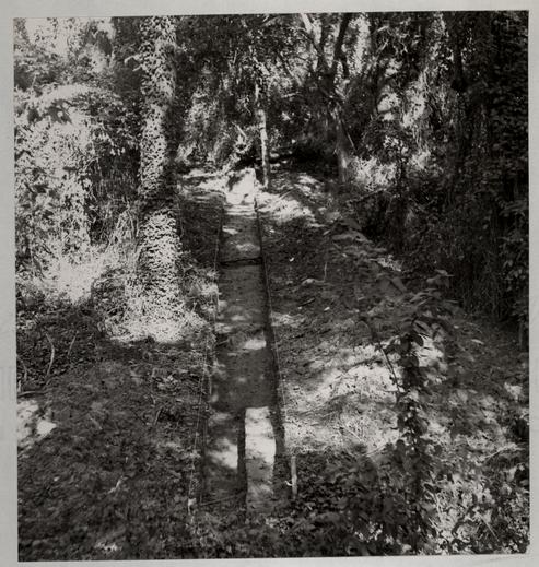 Fig. 38. Second test cutting through heavy underbrush to rear of site east of stream. See Vol. I, Fig. 8, section 2. Photo from the west. 60-841-5.